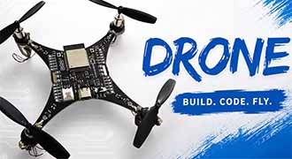
What Types of Sensors Used in Drones?
Drones have become widely used auxiliary tools across various industries, and their core operational capabilities rely on the coordinated support of multiple functional chips. These chips come in a wide range of types, each serving a specific role, including power management ICs, microcontrollers, inertial and gyroscope chips, and RF transceiver chips. Among them, drone sensors, as core control components, operate throughout flight control, environmental perception, and task execution, playing an irreplaceable role in diverse application scenarios. This article will provide a detailed introduction to what are the sensors used in drones, how they work, and applications.

What is Sensors for UAV?
Sensors can accurately collect various physical parameters such as temperature, light, magnetic fields, and acceleration, and convert them into electrical signals or digital outputs that can be recognized by the system. Essentially, they are signal acquisition and conditioning components that enable the conversion between different forms of energy, providing the fundamental basis for equipment to perceive the external environment.
How Do Drone Sensors Work?
The sensors working principle of drone sensors is a closed-loop process of "sensing → converting → transmitting → feedback." Essentially, sensors capture physical and chemical parameters of the drone itself and its external environment through specialized sensitive elements. They convert non-electrical signals-such as displacement, angle, temperature, and distance-into electrical signals recognizable by the drone's flight control system. After basic signal conditioning, these signals are transmitted to the microcontroller, providing precise data support for flight control and task execution, ensuring stable and efficient drone operation.
- Signal Acquisition: Sensors use built-in sensitive elements-such as piezoelectric components in inertial sensors or infrared emitters and receivers in distance sensors-to capture real-time physical quantities. These include angular velocity and acceleration related to flight attitude, altitude, distance, and temperature from the environment, as well as task-specific data such as images or gas concentrations.
- Signal Conversion: Since the drone's flight control system can only process electrical signals, sensors use conversion circuits to transform the collected non-electrical physical quantities into voltage, current, or other electrical signals. During this process, the signals are also filtered and amplified to reduce external interference, ensuring accurate measurements.
- Signal Transmission and Feedback: The converted electrical signals are transmitted via interfaces to the drone's core control unit (microcontroller). The control unit uses the data to adjust flight attitude, trajectory, or perform specific tasks. Execution results are then fed back to the sensors, enabling dynamic adjustments and forming a complete operational closed loop.

What Types of Sensors Used in Drones?
Sensors are key components that enable drones to perform their tasks. Each sensor has a specific role, forming a comprehensive monitoring network that supports everything from basic navigation and visual capabilities to environmental perception. This ensures that drones not only fly stably but also see accurately and measure precisely in various scenarios.
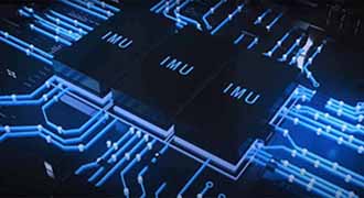
IMU – Inertial Measurement Unit
The IMU, or Inertial Measurement Unit, is the core perception component that allows drones, as well as other aircraft and robots, to achieve autonomous motion. It mainly consists of two parts:
- Accelerometer: Measures linear acceleration along the three spatial axes. By analyzing changes in acceleration, the drone can calculate trends in velocity and displacement.
- Gyroscope: Measures rotational angular velocity along the three axes, reflecting the drone's tilt, roll, and yaw.
By fusing the data from the accelerometer and gyroscope, the IMU can continuously calculate the drone's attitude, velocity, and motion in real time. This provides critical inertial information to the flight control system, ensuring stable flight and controllable posture.
1. Navigation Sensors
IMU (Inertial Measurement Unit)
Measures the drone's acceleration, angular velocity, and attitude angles in real time, helping the drone maintain stable flight and correct posture. It is a core component of the flight control system.
GPS
Provides position, velocity, and heading information, enabling precise hovering, route navigation, return-to-home, and accurate positioning.
Barometer (Pressure Sensor)
Calculates relative altitude based on atmospheric pressure changes, assisting in altitude holding and detecting changes in elevation.
2. Vision Sensors
Visual Sensors
Capture environmental images for tasks such as visual obstacle avoidance, visual positioning, aerial photography, target recognition, and path planning.
High-Resolution Camera
Captures high-definition photos and videos, supporting aerial photography, mapping, inspection, reconnaissance, and documentation tasks.
Thermal Imaging Sensor
Uses infrared radiation to form images, allowing operation in night, smoke, or low-light conditions. Common applications include search and rescue, inspections, temperature measurement, and reconnaissance.
3. Environmental Perception Sensors
LiDAR (Light Detection and Ranging)
Emits laser beams to measure distances and create models, enabling high-precision obstacle avoidance, terrain mapping, 3D reconstruction, and autonomous navigation around obstacles.
Infrared Sensors
Detect infrared signals to support night-time perception, obstacle detection, and heat source identification.
Sonar / Ultrasonic Sensors
Measure short-range distances, mainly used for low-altitude altitude holding and close-range obstacle avoidance. They are cost-effective and respond quickly.
4. Magnetometer (Electronic Compass)
Senses the Earth's magnetic field to provide heading information, assisting GPS in correcting direction and ensuring the drone maintains an accurate course.
5. Temperature Sensors
Monitor ambient temperature in real time, providing environmental data that supports mission execution and ensures the drone can operate effectively under varying conditions.
6. Multi-spectral Sensors
Capture spectral data across multiple bands of light, commonly used for professional applications such as agricultural vegetation monitoring, environmental monitoring, and resource exploration.
7. Specialized Sensors
Depending on the mission, drones can be equipped with various specialized sensors
- Gas Sensors: Detect toxic or flammable gases.
- Humidity Sensors: Monitor environmental humidity.
- Collision Sensors: Detect impacts to protect the drone body.
- PM2.5 / Particulate Matter Sensors: Measure atmospheric dust and particle concentrations for environmental monitoring and air pollution inspection.
- Light Sensors: Detect ambient light intensity, assisting camera auto-exposure and determining day/night and flight conditions.
- Noise Sensors: Collect environmental noise data for monitoring and noise source localization.

What Do the Sensors Do on Drones?
Ensure Flight Safety and Stability
A single sensor is easily affected by environmental interference-for example, GPS signal loss or blocked visual sensors. By working together, multiple sensors allow the drone to hover steadily, maintain precise altitude, follow correct headings, and avoid loss of control or crashes.
Enable Comprehensive Environmental Awareness
Different sensors excel in different scenarios: LiDAR is ideal for precise distance measurement and obstacle avoidance, ultrasonic sensors are suited for low-altitude detection, thermal imaging can see through darkness and smoke, and multi-spectral sensors monitor vegetation. Only by combining these sensors can drones accurately perceive complex environments.
Improve Navigation and Positioning Reliability
GPS handles outdoor positioning, the IMU manages attitude, the magnetometer provides direction, and the barometer assists with altitude. By fusing data from multiple sources, drones can operate reliably even in challenging signal environments such as indoors, under bridges, or between buildings.
Support Various Professional Missions
Aerial photography requires high-resolution cameras, agriculture relies on multi-spectral sensors, search and rescue uses thermal imaging, and environmental monitoring depends on gas and temperature/humidity sensors. Equipping drones with specialized sensors allows them to perform diverse tasks such as mapping, inspection, rescue, and crop protection.
Complement Data and Reduce Errors
Single sensors have limitations or blind spots, but multiple sensors can cross-validate and fuse data, improving measurement accuracy and decision-making reliability. This makes flights safer and mission results more trustworthy.

Drone Applications & Uses
- Daily aerial photography, landscape shooting and short video recording
- Outdoor flight positioning, fixed-point hovering and automatic return-to-home
- Simple terrain observation, site inspection and on-site image transmission
- Simple monitoring of meteorological environment, such as collection of temperature, air pressure and wind speed
- Drone Sensors for Agriculture
Equipped with multispectral sensors, temperature sensors, humidity sensors and vision sensors, drones enable precise farmland monitoring. They can quickly collect data on crop growth, soil moisture, pest and disease distribution, assisting farmers in precise fertilization, irrigation and pesticide application to reduce resource waste and improve agricultural production efficiency. Meanwhile, through the coordination of GPS and IMU, full-coverage farmland inspection and accurate operation path planning are realized.

- High-Risk Scene Inspection
Various sensors are used to realize automatic detection in areas inaccessible to humans, such as elevated bridges, remote oil and gas pipelines, communication towers, high-voltage transmission lines, etc. Safety inspections are completed through precise sensing and imaging.
- Urban Logistics & Residential Delivery
Relying on multi-sensor integrated navigation, delivery drones maintain stable and trouble-free flight without getting lost in complex urban environments, achieving safe and reliable last-mile delivery.
- Intelligent Monitoring in Automated Factories
Continuously monitor pipelines and production equipment inside factories and identify anomalies, improving production safety and operation and maintenance efficiency.
In future, drone transducers will place greater emphasis on precision, accuracy and reliability to meet scenarios with extremely high requirements for data quality and flight safety, such as mapping, agricultural plant protection, emergency rescue and industrial inspection.
How to Choose the Right Sensors for Drone Systems
1. Accuracy and Stability
The data accuracy of sensors directly affects drone positioning, attitude control and task execution. Meanwhile, stable output with minimal drift must be ensured during long-duration flight and under various operating conditions, so as to avoid flight instability or inaccurate operation results caused by data errors.
2. Size, Weight and Power Consumption
Drones are sensitive to payload and endurance. Selected sensors must be lightweight, miniaturized and low-power consumption. On the premise of meeting performance requirements, their impact on aircraft load and battery life should be minimized as much as possible.
3. Environmental Adaptability and Anti-Interference Capability
Drones often fly outdoors in complex scenarios. Sensors need strong environmental adaptability to work normally under conditions such as high and low temperatures, vibration, electromagnetic interference and changing light, without failure due to external factors.
4. Matching with Task Scenarios
Select appropriate sensors according to the actual application of the drone. For example, aerial photography focuses on high-definition imaging, inspection requires thermal imaging or LiDAR, and logistics delivery emphasizes reliable navigation, ensuring that sensor functions are highly consistent with application requirements.
Leading Drone Sensor Manufacturer
Precise flight, environmental awareness and mission execution of drones rely on high-performance sensor hardware. Leading drone sensor manufacturers drive industry development with core technologies and reliable products, balancing superior performance, stable quality and drone sensor price.
ADI excels in industrial-grade high-precision inertial sensing, with products emphasizing high stability and anti-interference capabilities, widely used in high-end industrial and mapping drones. The ADIS16488 is a 10-axis tactical-grade inertial sensor integrating a 3-axis gyroscope, accelerometer, magnetometer, and barometer. It features factory full-temperature calibration and low drift, providing accurate attitude and navigation data for drones. The ADXRS453BRGZ-RL is a high-vibration-resistant single-axis gyroscope adopting a differential four-sensor architecture, which effectively suppresses vibration and linear acceleration interference. It can output stable angular velocity even under complex flight conditions, ensuring reliable flight control.

STMicroelectronics
As a leading supplier of MEMS inertial sensors, STMicroelectronics balances high performance and low power consumption, covering the consumer to industrial-grade drone markets. The LSM6DSV32XTR is a new-generation high-performance 6-axis IMU with low noise and a wide measurement range, equipped with an intelligent processing core to meet the needs of high-speed flight and image stabilization. The LSM6DS3TR-C is a cost-effective 6-axis IMU featuring low power consumption and integrated FIFO. It optimizes system power consumption while ensuring attitude measurement accuracy, making it a common choice for small and medium-sized drones.
Infineon
Infineon boasts prominent advantages in the field of high-precision barometric and environmental sensing. The DPS368XTSA1 is a miniature digital barometer based on capacities sensing technology, with low temperature drift and centimeter-level height resolution. It supports dual measurements of barometric pressure and temperature, features low power consumption, and is resistant to moisture and dust, providing reliable data support for drone altitude hold, return-to-home, and meteorological sensing.
Final word, as a leading sensor hardware supplier, Eastech specializes in end-to-end supply chain solutions for drones and industrial electronics. As a core authorized distributor of top brands including ADI, STMicroelectronics, Xilinx, Intel, and Infineon, we offer a comprehensive portfolio of IMU, MEMS, pressure, and sensing products. Guaranteeing 100% genuine components, competitive drone sensor price and stable inventory, we empower customers achieve faster time-to-market for high-performance drone systems.
Related information
- 2026.07.19 What is GDDR Memory?
- 2026.05.05 What are Inertial Measurement Units?
- 2026.03.31 How to Choose Between FPGA and ASIC?